

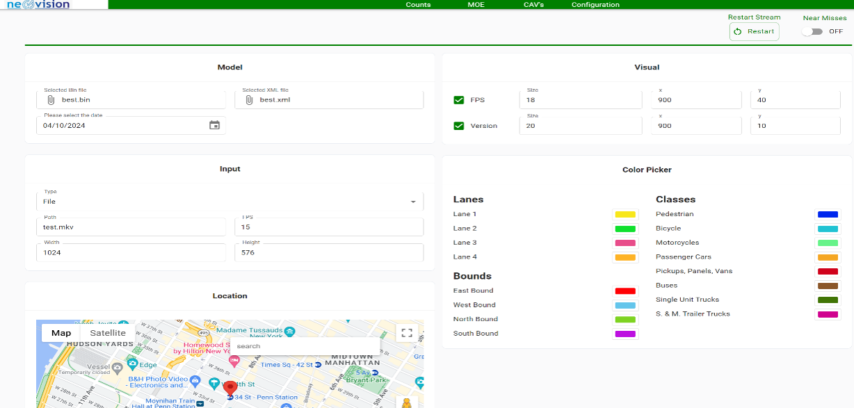
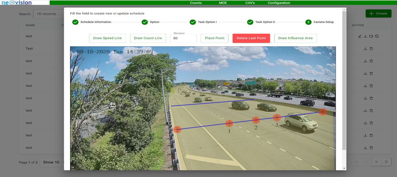
System Schedule, Setting, Calibration & Visualization
Real-Time Monitoring Operations
Advanced Traffic Flow Analysis

Comprehensive Network Visualization

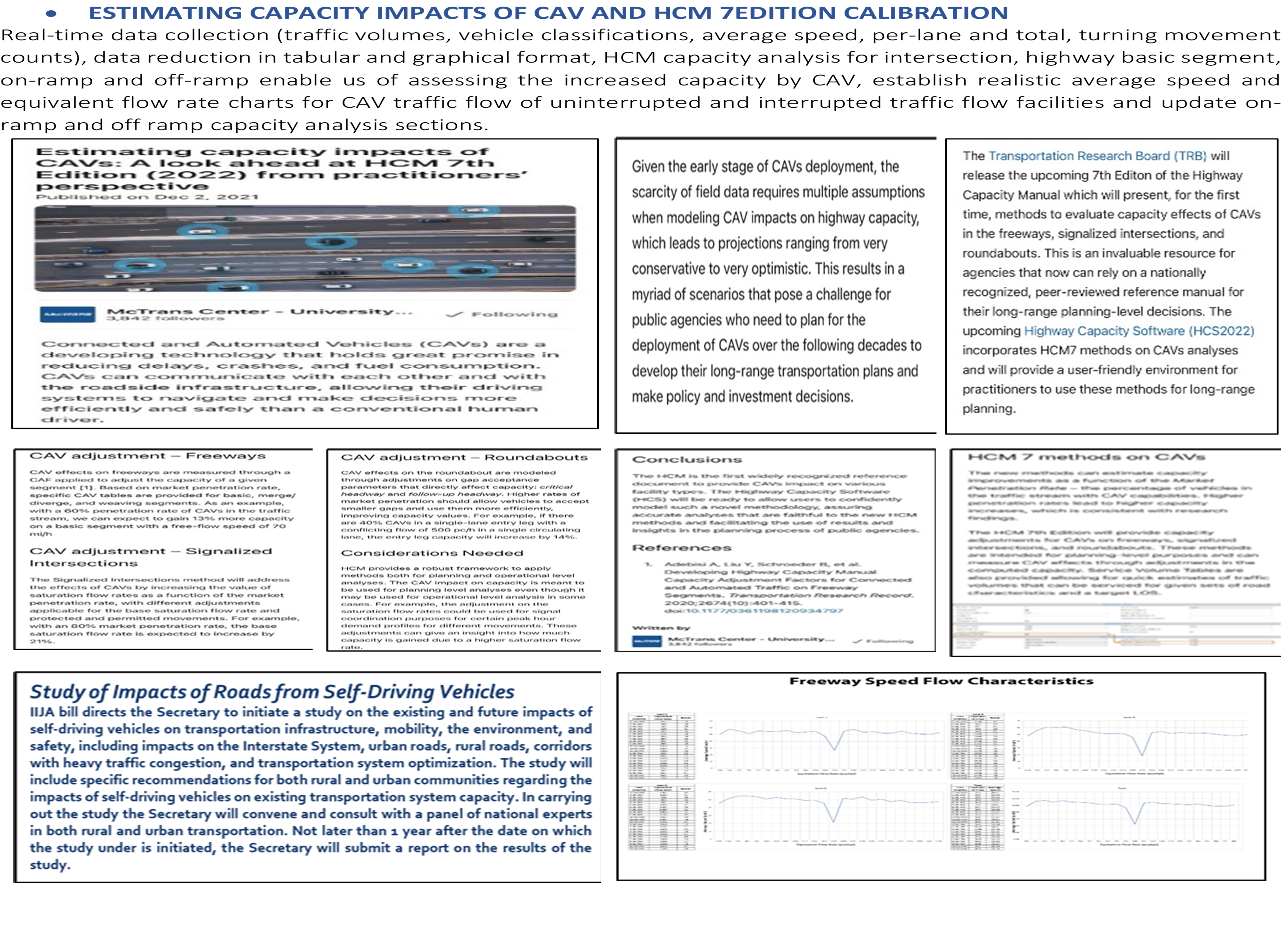
HCM Capacity Analysis & Analytics (15-min intervals)
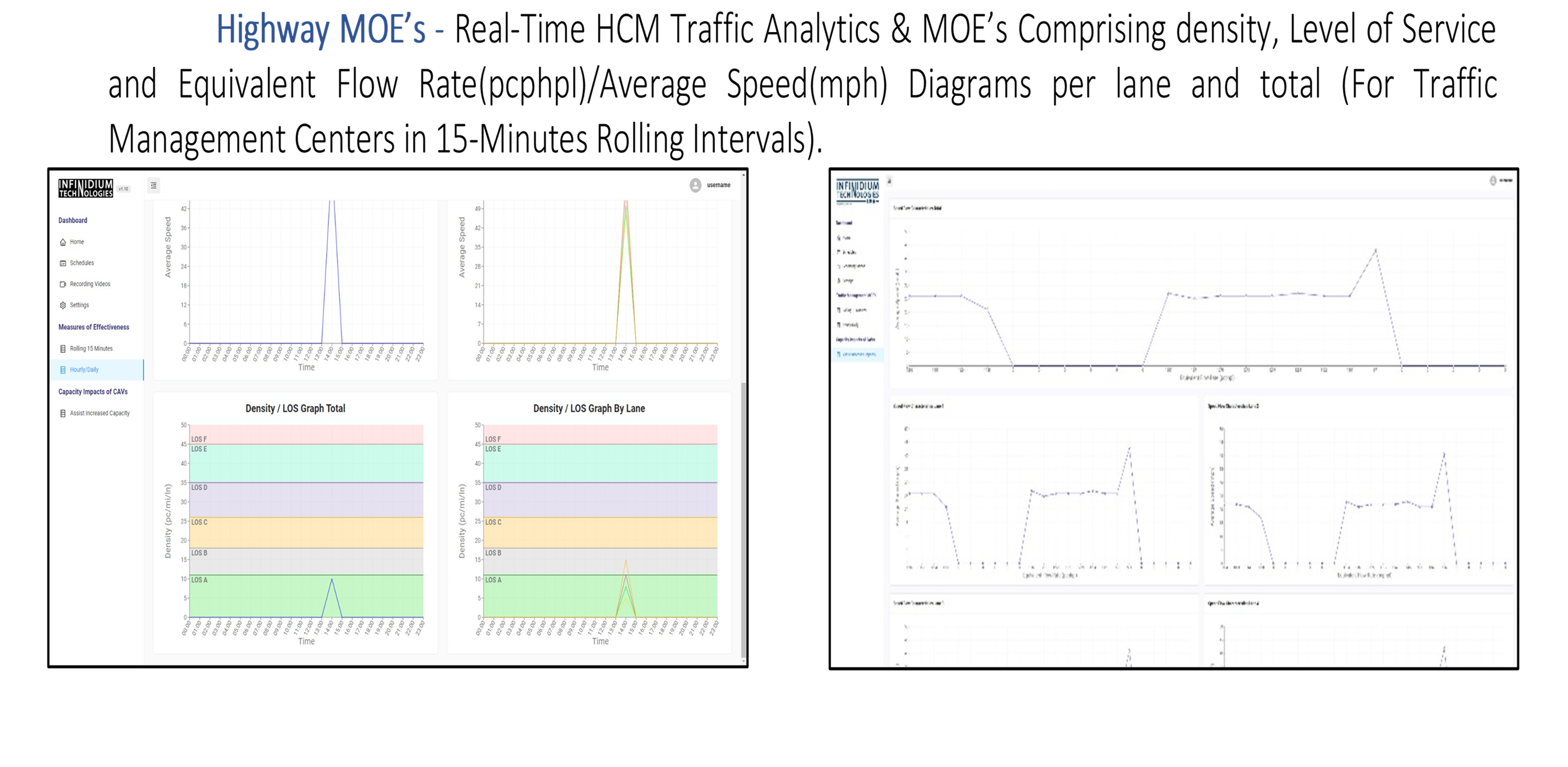
Real-Time MOE's & Level of Service Diagrams
Operational Calibration & Setting

Average Speed & Equivalent Flow Rate
The system collects traffic data (volume and speed) in real time for vehicles (Vehicle Classifications), pedestrians, and bicyclists; and this data is exported to Synchro, and Vissim. This provides the operation at central points to visualize, verify, and measure the level of service and all the incidental activities at the intersection. This is correlated with a digital twin technology approach, where simulation is verified by real time data and visualization of the intersection performance.
Real-Time Analytics
Accurate volume and speed data collection in real-time for all vehicle classifications.
Multimodal Tracking
Comprehensive counting regarding vehicles, pedestrians, and bicyclists movements.
Simulation Sync
Seamless data export to Synchro and Vissim for validated system operations.
Digital Twin
Correlate real-world performance with simulation data for a true digital twin experience.